|
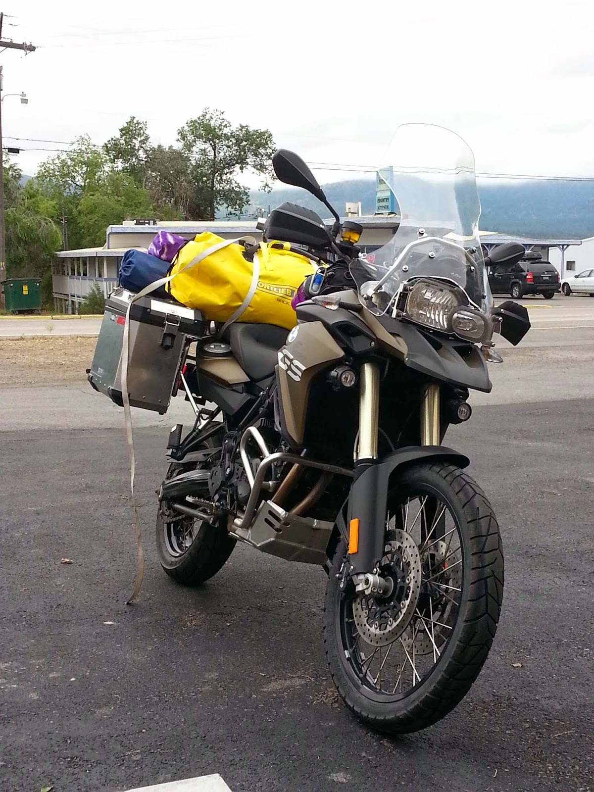
| Stopped at Longmire, Mt. Rainier National Park |
Day 1. Tuesday, 7/30Left home at 10:12 AM. Finally on our way. Bikes are loaded and heavy.
First
stop at
Starbucks in Yelm at 11:15 AM and 34.4 miles. Kim was cold and
wanted a warm up. We couldn't remember where the Starbucks was so we
traveled thru several parking lots. Next fill up bikes at ARCO across
street.
Just after we left Yelm the skies cleared.
In Longmire for a pit stop. Kim keeps on wanting to stop. Each time lots of futzing about with things. Ugh.
The
"GPS" app that records gas mileage was messing with the Google My
Tracks app. Dang! This messed up me recording today's trip. So I
uninstalled it. To measure gas I put in $7.80 1.97 gals at 4.159 per
gallon.
Stopped at Paradise just to see the view. We got a couple of
pictures and talked to a couple of folks. It
 |
| Kim and her ride at Paradise, Mt. Rainier National Park |
|
We went on
down Stevens Canyon until we met up with some road construction. From
there to the park boundary we were behind slow vehicles which did at or
below the speed limit. Once we got to Hwy 12 we were able to move along
quite nicely. We stopped at the
Silver Beach Resort for some
cheeseburgers. Oh boy they're good. Besides that we were tired and
needed a break.
As we headed down into the Yakima Valley the
temperature got hotter and hotter. We were glad we changed into our
mesh jackets at Paradise. There was smoke in the air from the forest
fires south of Yakima. By the time we got to the motel (5:45 PM) it was
93F from a comfortable 77F. We got to our room, quickly unpacked the
bikes, and changed. I cranked the AC to as cool as it would go. I got
some ice and poured myself a couple of fingers of whiskey.
"Oooh dat good."
We're
better bikers now than we were two weeks ago. We rounded corners good
and felt more comfortable. Although I am still somewhat cautious on the
corners. The bike is heavy with gear so it acts a bit different. I do
believe the right side is heavier than the left.
Day's mileage: 185.3 mi.
For
supper we headed over to
Antojitos Mexicanos restaurant. We ate here
before and it was good. It's rated the best Mexican food in Yakima.
Today I'm having the Pambazo which is a Mexican sandwich smothered in
enchilada red sauce.
2.966 $4.059 $12.07 5176 163 54.76 mpg
sure was beautiful. We
changed from our heavy coats to our mesh coats which required some
unpacking and untying then re-packing and re-tying stuff.
Day 2. Wednesday, 7/31Adjusted rear spring from 6 turns to 12.
We
left the motel after 10 AM and went to
Starbucks for a coffee. From
there we went to the
Harley shop so Kim could get a "Cramp Buster" for
her bike. She also got some new motorcycle socks (the others were too
tight.). Finally on our way. We headed S on I-84 which was tricky
because of a merging on ramp. Then when going over a bridge my bike got
squirrelly because of grooved pavement. That spooked the crap out of me.
At the same time the GPS is screaming at me to turn around. The GPS is
not too keen on modified routes. Next on to Hwy 24.
As we motored
down Hwy 24 there wasn't too much car traffic but a lot of large truck
traffic going with us and against us. When one these big boys would pass
by going the opposite direction the wind gusts would violently shake
you and the bike. Ugh, I hate big trucks. The worst were the semi
tractor-trailer rigs hauling fruit. Each time i would see one
approaching I would prepare myself for the on coming wind blast.
About
7 miles out of Moxee Kim screams on the intercom that my left pannier
fell off the bike. It skidded across the road and stopped on the
shoulder. I turned around to get back to the scene. The top opened and a
few things came out but other than that the pannier wasn't in too bad
of shape. Some scrapes and a locking pin was busted off. The big semi
tractor-trailer trucks hauling fruit were zipping by within a foot or
two of us on the shoulder of the road. They didn't give us much lee-way
so we moved down the road to a wide spot. We spent almost two hours
trying to fix the pannier so we could get on our way. The biggest
problem was that the lock/latch mechanism wouldn't fully lock because
the case was slightly bent. Getting the bend out was the issue. To get
the bend out we needed to remove the pannier latch mechanism. The latch
was bolted to the case using two Torx screws. I was able to remove one
of the screws but the second screw was stripped and too tight. We tried
for oh so long in the heat and at the side of road to remove this screw,
but it would not budge.Finally we unbent the case by inserting an Allen
wrench through the other screw hole and pulling back on it with vice
grips. It kind of worked. The pannier was just un-bent enough for the
latch to secure the pannier to the bike. In addition I used a couple of
zip ties to secure the pannier to the pannier rack frame so it will not
fall off again. All of this took about a couple of hours to do.
Unfortunately I was spooked that something else will go wrong.
To get
a bit of a respite from our roadside repair, we stopped at the Vernita
Rest Area and had a pop. Then on our way again. Less traffic and less
big trucks. Boy that stretch between Vernita and Othello has one long
boring straight stretch. Glad the pannier didn't fall off there because
there was no shoulder and what shoulder there was, was sand. We started
off in the 90's but as we got to Othello the temperature cooled to the
low 80's. So glad we were using our mesh jackets. The cooler
temperatures felt great particularly when we cruised through orchards
with sprinklers - almost a 10 F drop from a few miles earlier.
We
turned right off of 24 to Hwy 26 in Othelko. We buzzed along on Hwy 26
after Othello until we got to the rest area on Hwy 395 & Hwy 26. We
stopped there for about 30-40 minutes and it felt great. I laid down and
almost took a nap.
After the Rest Area we felt a few rain drops as
we continued down Hwy 26. It looked as if there was some thunderstorms
ahead. Just past LaCrosse my low fuel light came on. As a result instead
of traveling the speed limit of 65 mph I slowed down to less - around
60 mph instead to get better fuel economy. As a result we got passed by
several cars - oh well. We got into Colfax with my reserve showing 24
miles used. We filled up at a Conoco: 3.97 gals at 178.9 miles traveled
or 45.1 mpg.. Oof I only had about 9 miles or less left.
After
fueling up we checked in at the
Siesta Motel in Colfax. Nice place. Kind
of "old fashioned" in that you went to your room and there was the room
key. After unpacking we walked across the street to
Eddy's Chinese
Restaurant. Food was very American Chinese but good after not eating
all day. I was glad this day was over.
Day's mileage: 183.1.
Day 3. 8/1About
8:00 AM Colfax was hit with good thunderstorm - lightning and rain. We
waited it out. Forecast looks to be wet today with scattered showers and
thunderstorms. Plan is to go to St. Maries, Idaho and reassess. We are
geared up for rain - heavier jackets versus the mesh jackets.
In the
meantime (waiting out the rain) I re-balanced the panniers so all the
weight is not only on one side. Hopefully this will help.
I also bought a replacement Allen wrench, better Torx tool and more "zip ties."
The
Siesta Motel was a great stay and would definitely recommend it.
We
finally left Colfax about 11:15 AM. We turned on to SR 272 and headed
out of town. What a beautiful road! We motored up and down hills
providing great Palouse views. In many places the wheat was ready to
harvest. In other places it was already harvested. Hay was rolled into
large bundles. We crossed into Idaho and onto Hwy 395 but only for 0.7
of a mile. Now on Idaho SR 3 we traveled through the small towns of
Princeton and Harvard. The highway rolled through farms and woods. We
entered the White Pine Scenic Drive which was beautiful. The feature was
the Palouse Divide - which fir us was a great curvy road. After the
White Pine Drive we turned on to Idaho SR 6 which took us to St. Maries.
 |
| Gourmet supper on the road |
In St. Maries we stopped for lunch at
Buds Burger Drive in.
Followed by some grocery shopping for supper, and finally to fill up on
gas even though we didn't need to.
Got gas: 1.21 gals; $4.279/gal.; miles since last fill:74.7; Total miles: 5429. 61.7 mpg.
St.Maries is a busy place with cars, trucks, and various big trucks - logging and dump trucks.
Finally
on to the St. Joe River Road. The traffic was definitely less, although
heavily loaded log trucks were going to St. Maries. About halfway to
Avery we had a summer rain shower, but fortunately it didn't last long. I
was amazed at all the camping along the river. The road is in good
shape with lots of curves. We paused at Saddleback Campground but
continued on to Turner Flat Campground where we found a nice spot not
far from the river. We relaxed and made a nice Puttanesca supper. After
supper you could hear thunder in the distance which meant that a
thunderstorm was approaching. We quickly cleaned up camp and went to
bed.
We listened to the thunder and counted when we saw the
lightning. The closest was about 3 miles away. The rain followed and
never really stopped - that's the bad part. The tent is not designed for
camping in the rain. Small puddles formed inside the tent getting most
things wet. I woke about 3 AM went to the restroom and had enough of
laying in puddles, so I brought the camp chairs into the tent and slept
in them. Kim seemed to be drier than me. Surprisingly I slept okay
although sitting in camp chairs.
Day 4. 8/2There was
more water in the tent than outside. I was surprised at the weather
because this was not in the forecast. We hurried and broke down camp. We
continued our drive up the St Joe River Road - it is so beautiful, too
bad there were low clouds, rain and fog which affected the views. The
road left the river and started to wind and climb up into the mountains.
As we made for the pass - the Idaho Montana border - it was totally
fogged in. Also the road turned from pavement to gravel. We stopped to
pause at the border to consider the gravel road before us. Driving on
gravel had us a bit wary, but this was wet gravel and mud. We recognized
that this was going to test our motorcycling skills.
We started out
very slow but picked up speed as we got more familiar with the road
conditions,. The road was very muddy but not soft. Either the road
wasn't as bad as we imagined, or our motorcycling skills were improving,
or both. The weather seemed to get better as we descended into St
Regis, Mt. Pavement was reached just a few miles out of St Regis. We
stopped at a tourist restaurant and had lunch. It was nice to get some
hot food. We also felt like we had accomplished something. Covered in
mud many Harley riders on there way to Sturgis looked at us with some
amazement.
We turned left in St Regis on to Montana State Route 135
and made our way to our destination of Plains. SR 135 follows the Clark
Fork river through the mountains. Again, a very scenic road with several
large sweeper curves - a great motorcycle road. There was quite a bit
of traffic on the road - mostly vacation travelers with motorhomes and
cars/trucks pulling trailers. For once I was happy to have them on the
road with me because they too didn't travel the 70 mph speed limit. We
settled in behind some slower travelers and let the faster cars pass us.
SR 135 ends when meets up with Montana 200.
We turned left on to SR
200 and to our day's destination - Plains. Only nine more miles to go.
As a fitting celebration, the rain stopped, the clouds parted, and we
saw the sun. We made it to Plains, Montana. Now a few days of rest.
We
got settled into a wonderful little motel called the
Dew Duck Inn. A
very quaint motel. Each room is unique in its layout and each room is
fashioned with unique quilts made by the owner. Seeing our muddy bikes
the owner provided me with a bucket and rags and a place to was up the
bikes. I guess they didn't want muddy bikes to take away from the quaint
ambiance and possibly mess up the rooms. I washed up the bikes to get
the mud off which was quite a chore. The mud was everywhere - in every
nook and cranny. The mud was also tenacious because you couldn't just
wash it off but work to wipe it off too.
Day 5. Plains, MT.Got gas: 2.67 gals ($3.839/gal), miles since last fill: 134.1; total miles: 5563. 50.2 mpg.
We had to check out of
Dew Duck Inn for today so the question was,"
What to do until we can check in?"
A thought was to motor to Trout Creek to the Huckleberry Festival.
Trout Creek is 47 miles away. As soon as we got started Kim heard a loud
rattling noise. So we pulled in to downtown Plain to check. Kim's
motorcycle chain was definitely loose. So we tightened that. Luckily I
had the correct tools. Off again, but the problem was not solved. I had
to turn around to meet Kim. We pulled inro a Montana DOT area to check
it out. A fellow adventure biker doing route exploration pulled in to
assist us. We determined that Kim's chain tughner was loose. I tightened
that and that did the trick - no more noise. So, once again we started
off towards Trout Creek only to hit a small rain storm - ugh, that was
enough for me. I suspected that this was a sign to stop. So we pulled
over and turned around to go back to Plains. Kim called the motel -
Glacier Crossing - and they said we could check in. We were both
relieved. We were both tired and needed a break friom riding. So we
checked in to the motel and relaxed since Kim has to work tonight.
Later in the day we went to
Quinn's Hot
Springs for a soak and supper. We didn't take the bikes because Kim's
co-worker Sondra drove. Oh how I relished soaking in the hot spring
pools. There are many pools - from cool to really hot. The pools are
separated by walls which you can easily climb over into the next pool. I
wandered from pool to pool - cool to hot and then back to cool only to
repeat the process. The stress of the pannier falling off, the passing
trucks, the traffic, and the muddy drive all seemed to dissolve. After
an hour or so of soaking I was fully relaxed and ready for supper.
Supper was good, but the hot spring soak was the best.
Day 6. 8/4, Sunday
 |
| Adventure motorcycle |
Moved
back to the
Dew Duck Inn. First real opportunity to spread all the wet
camping gear out to dry - tent, sleeping pads, and sleeping bags. It was
a hot sunny day so it didn't take long to dry out the soggy gear. Once
dry, I re-packed it all.
Day 7. 8/5 MondayDrove
around Flathead Lake. Headed east on MT 200 and turned on MT 28 and
drove to Elmo. First part was very beautiful with rocky hills, pine
forests and a nice curvy road. Once you get close to Hot Springs and
after, all the way to US 93 there are long straight streches.
US 93
is busy with travelers on their way to Glacier National Park. The road
winds along the west side of Flathead Lake through several tourist towns
and vacation cabins. Of course the speed limit is 70 but I chose to do
60 and would occasionally drive on the road shoulder to let cars go by.
At Somers I turned right on to MT 80 that goes across the valley above Flathead Lake
. Then
I turned right again on to MT 35 which goes down the east side of
Flathead Lake. Just past the town of Bigfork I turned into Wayfarer
State Park to take a short break. I found a picnic spot right by the
water. I looked at the map, munched on a snack of nuts and drank some
water. Just as I was getting ready to go the family at the next picnic
site invited me to join them for Bannock bread and fruit.
Bannock
bread is simply bread dough wrapped around a weanie roaster stick and
cooked over the fire. How fun. While the bread "baked" we chatted. When
the bread was done, I ripped it in half length-wise and smeared peanut
butter on it. When I said I was going to go, they wanted a picture of me
with them. I gave them my email address hoping that they will send me
the Bannock bread dough recipe.
I then headed south on MT 35 all the
way to Polson. I got gas in Polson: 2.51 gals; $3.989/gal; 133.4 miles
since last fill-up; 5697 total miles: 53.1 mpg.
The GPS had me take
some back streets out of Polson so I could avoid US 93. The back roads
started out fine, but in hindsight I should've turned left versus right
because next thing I know is that I'm traveling down these narrow gravel
roads out in the middle of nowhere. I traveled by farms and fields, and
even along the Flathead River. After about 5-6 miles of gravel, the
road switches to a coarse single lane of pavement. I followed this until
I turned right onto MT 352. This in turn takes me along the west side
of the National Bison Range and finally back to MT 200.
I am now 33
miles from my start in Plains. It is getting hot. My air temperature
guage is reading 92 F! As I cruise closer to the Clark Fork river the
temperature drops but only about 4-5 F. I get into Plains about 3:30 PM
almost 7 hours from when I started. I am pooped. 188.7 miles. Not a bad
day.
Day 8. 8/6 Tuesday.
 |
| Steel horse versus real horse |
Visited
the Plains Ranger Station and picked out a Kootenai National Forest map
for tomorrow's trip. The USFS front desk person said it was a good road
and we shouldn't have any problems. I then scouted a portion of the
road myself - at least to see what the condition was like. From the USFS
Ranger Statiion it's paved for 3-4 miles. I accidentally went straight
when I should've turned. Shortly after turning left the changes to
gravel. The road is hard packed dirt with some (not lots or deep) gravel
on top. It looks to be a good road. I estimate that we'll travel on
gravel for about 46 miles. That and the othee concern was that I did see
several logging trucks coming down the road to Plains. The gravel and
paved, or most direct route to McGillivray campground from Plains
(County Rd 558-US 2-McKillop Rd.) is 97 miles (3:40) versus the MT
200-MT 85-US 2 route is 139 miles (2:50). Hmm? 46 miles at 25 mph is
almost 2 hours itself on gravel roads. But we are off the beaten highway
path.
I then created the most direct route in the GPS and researched
USFS campgrounds along our planned route for the next couple of days.
Better do it now since there's no Internet access for the next few days.
Tomorrow (Wed. 8/7) McGillivray for sure, but for Thursday (8/8) I
was interested in Yaak Falls (7 sites, no water, 98 mi.) but Whitetail
(12 sites with pump water, 81 mi.) Pete Creek (13 sites with water, 78
mi.) may be better options. Red Top campground between Yaak Falls and
Whitetail is only 3 sites and no water.
Day 9. 8/7 WednesdayWe
left Plains at 10:30 AM. We stopped to top off with fuel (which I was
glad I did). 1.68 gals, $3.839/gal; 88.6 mi since last fill; 5786 total
miles; 52.6 mpg.
We went through Plains and turned right on Clayton
Ave. We drove out of town where Clayton turned
 |
| Beautiful Montana back roads just outside of Plains, MT. |
into Lynch Creek Rd. At
about 4 miles the road ended and the gravel started. We followed this
road until we met up with the Little Thompson River Rd. Most of the time
the road was more hard pack dirt versus gravel. Although in places the
gravel was more pronounced. We traveled between 25-30 mph. A couple of
times the road was very rough with washboards and pot holes so we drove
standing up - although I preferred to sit down. (What kind of adventure
rider am I?) What I thought was a county or Forest Service road was
actually a private logging company road. I preferred this road over the
FS road. Many times the FS road paralleled the private road. When they
diverged we chose the private road because of its width and condition.
The FS road was generally very narrow and road conditions not that good.
We traveled over 46 miles on these gravel roads (private, county,
and FS) and only came across a few other vehicles (going the opposite
direction - no cars passed us), one of which was a log truck - for this
guy we pulled over (much to Kim's chagrin).
Just near the end we had
a couple of obstacles - (1) two cattle on the road, and (2) some huge
holes in the road. The cattle were wandering down the left side of the
road. They didn't know what to think when I came up to them. I saw them
turn and bolt in my mirror. Kim slowed and passed them too. Farther down
the road, the road seemed to collapse creating two huge sink holes at
least 12" deep. These holes were dangerous. There was no marker or
warning - another reason to take it slow and easy. If you would've been
standing, you probably would've been tossed forward over the handle
bars. At about 1 PM we made it to US 2 and turned left.
The change
from gravel to highway was strange. Going 55-60 seemed so fast, and
dealing with cars and trucks passing you because they were doing 70+
mph. We liked the back roads better. Although this strech of US 2 was
beautiful with the Thompson lakes off to our left. The plan was to fuel
up at
Happy's Inn on US 2 but it was closed - closed on Wednesday's. So
we moved on down US 2 turning right on to McKillop Creek Rd (about 11
miles from when we turned on to US 2).
Wow, McKillop Creek road is a
beautiful road. It can't be more than a few years old - it was so
smooth. We traveled on this road for about 30 miles winding through the
woods and eventually to the Fisher River. It's mostly a one lane road
although when it meets up with FS 273 it's a two lane road. Again the
traffic was light but we did experience more vehicles - both coming and
going. Also it was getting hot - temperatures were in the upper 80's and
low 90's. My temperature guage read 92 F at times.
FS Rd 273 ends at
MT 37 where we turned left to go to Libby. We had to detour 11 miles to
a gas station. And this was no ordinary gas station - it sold fishing
tackle and guns/ammo besides groceries. We fueled up for the next leg of
our trip. I got: 1.65 gals, at $3.799/gal; 98.4 mi since last fill, and
5884 total miles; 59.6 mpg.
We made some requisite phone calls since we would be out of cell service for the next few days. Then off again.
 |
| Kim and Lake Koocanusa |
We
back-tracked the 11 miles to our turn on to FS 228 or the west-side
Lake Koocanusa road. Almost immediately there were nice curves and the
temperature was about 6 F cooler - whew. We stopped to take some
pictures as there was a great view point of lake and dam. The road was
average with a lot of "black tar snakes" all over the road. In the heat
it did make them kind of slick when you went hard around a corner - so
you had to exercise some caution. My front tire slipped once on one
corner.
We got to McGillivray Campground (about 11 miles from MT 37
turn-off) around 4 PM and found a campsite. Upon inspection of our
bikes there was dust everywhere from the gravel roads earlier. Poor Kim
got the worst of it as she was behind me the whole time. I lead because I
had the GPS and had thoroughly studied the route.
We set up camp
and Kim again said her chain was "clanking." Sure enough it was loose -
very loose. So, we worked on adjusting her chain. I tried to make
sure both sides were equal in their distance. I tightened it once but
the chain was too tight. I was adjusting the chain tightening screws but
also the axle nuts. I think the correct procedure is to simply adjust
the chain screws and don't mess with the axle nuts. I'll keep watch on
it. I also applied a liberal spray of WD40 on to the chain which I
believe helped.
We then started on a supper of "creamy chicken
fettuccine." (Canned chicken, can peas and carrots, 3/4 pkg of cream
cheese, and pasta.) It was very good. Seems like my pre-packaged
seasonings are working out really well.
After supper we used the
bikes to go to the swimming beach as it was quite a ways (maybe a mile
or more) from the camp site. I took a quick wade in the water. Ooh it
was so refreshing. Then back to camp and we were done for the day.
I pondered on the day and was impressed on how well we did the 46 miles of gravel roads. For me this was an accomplishment.
Day 10. 8/8 Thursday.
 |
| Lake Koocanusa, Montana |
We left camp about 11:30 AM. Turned north on FS 228
. Beautiful
morning. We made our way at a very relaxing pace, generally 40-45 mph.
It's a great road with great scenery and lots of curves. The road
surface is okay. At abour 1 PM we made it to the "Rexford bridge"
crossing Lake Koocanusa. We the took FS 92 which took us to Yaak.
This
road climbed steeply with many hairpin corners up the side of the
mountains to climb out of the Kootenai River Valley. At one point I
almost collided with a deer bolting across the road. The temperature
near the lake was in the low 80's, at the "top" the temperature was in
the mid 60's. The "pass" or "top" (which there really wasn't) made the
headwaters of the Yaak River. There's plenty of corners on this road.
After the pass the trees become more sparse and the forest changes from
spruces to pines, particularly Ponderosa Pines. The continues to wind
through the woods all the way to the small community of Yaak. You know
you are approaching civilization when telephone poles line on side of
the road. Some sections of road were being oiled with new gravel.
We
got to Yaak and stopped at the
Yaak Store/Tavern. We had a couple cold
drinks, a fancy cheeseburger, and Poutine. Well Kim had to instruct them
on how to make Poutine - and it turned out well (fries with gravy and
shredded mozzarella cheese) - the food was all good. The place was busy
with quite a few bikers - Harley's, and cafe style. The poor
waitress/bartender/cook was one busy gal. Most of the vehicles we saw
today were other bikes.
It started to rain a bit and it was getting
late in the day so we stopped at Pete Creek campground. There
 |
| Pete Creek campground, Yaak, MT |
were two
campsites available - we took one. And within an hour all campsites were
taken.
Since we had just eaten, we had a light supper of cream
cheese with bits of pepperoni on crackers along with some cheese curds.
It hit the spot. Later Kim found out that the brown containers that
looked bear proof garbage cans were actually bear-proof food storage
containers. It reminded us that we're in bear country - grizzly bear
country. So we asked to share a container at the neighboring campsite.
This was interesting because our neighbors were bikers too. They had a
pair of Suzuki V-stroms that were modified for off-road use. The couple -
Colin and Chloe - were on their way to Tierra del Fuego in South
America. Already they had been on the road for 6-7 weeks driving from
Winnipeg, Saskatchewan. They were tired of the cold and were headed
south. We told them of "Around the World Biker - Rene Comier." We also
told them of some routes we had traveled - particularly the St. Joe
River road. We also kind of gave them a route to their upcoming
destination - Portland, Oregon - via pretty much the route we had taken.
Kim gave them her Washington and Idaho highway maps. We bid them good
luck and safe journey and then went to bed.
Day 11. 8/9 Friday. Woke
to clear skies. We left our camp at 10:10 AM to continue on our trip.
Cruising down the Yaak River Road was great - no traffic and good road.
Even going down US 2 was good - no traffic. As we motored down the road
the temperature slowly rose from 66 F to 83 F. When we crossed into
Idaho we gained the hour we lost when we entered Montana. We pulled in
to an
Exxon in Bonners Ferry for fuel and some breakfast. We now had a
40+ mile run on US 2 and US 395. We missed a turn and ended up having to
drive through downtown Sandpoint, Idaho. What a tourist place and a
whole lot of traffic. After Sandpoint we continued another 25 miles on
US 2 to Newport, Washington. We motored along the east side of the
Priest River through mostly timbered areas dotted with farms.
In
Newport we stopped for a break at a
McDonald's. It was cool, and we
could relax. From Newport we turned off of US 2 on to Hwy 20. Good to be
off of a major thoroughfare.
We drove about 10-14 miles until we
could turn off to get to Flowery Trail road. Flowery Trail road is a
nice road, except at the Stevens County line the road was being freshly
oiled which meant over 25 miles of driving on gravel. The speed limit
was supposed to be 25 mph but no one drove that speed except for us. We
pulled over a couple of times to let those who wanted to go faster, go.
The fresh oil lasted all the way to Chewelah. At Chewelah we checked in
to the
Chewelah Creek Inn for the night. We walked to a relatively new
eatery in town -
Mondo's - a nice Italian food eatery.
Day 12. Saturday, 8/10.Late
last night thunder, lighting, rain moved through the area. Watching TV
news and weather confirmed most of Washington is getting scattered
thunderstorms. The weather forecast for a large area of the North
Cascades was to get storms and rain. Kim nor I were interested in
camping in the rain so we reserved a motel room in Winthrop.
In the
morning after looking at the weather forecast - 60% chance of showers
and thunderstorms - we called the motel and they confirmed the wet and
stormy forecast. Winthrop was getting hammered with thunderstorms and
heavy rain. So, at breakfast we made a decision to head south to
Ellensburg for the night. No North Cascades this year.
As we were
getting ready to leave, a couple asked which way are we going? We told
them State Route 231. They replied that that road too was being oiled
with fresh gravel, nearly 25 miles. Ugh, we weren't in the mood for that
so we took an alternate route - the Addy-Cedonia road and then go down
SR 25 to Davenport.
The Addy-Cedonia road was gorgeous - good road,
curves, and great scenery. What a treat to start out a long day's ride.
We then turned left at Cedonia and motored to Fort Spokane/Seven Bays.
We pulled into the picnic area and took a rest. From there we drove 25
miles to Davenport where we fueled up before
"crossing the desert."
We
took SR 28 to Ephrata via Harrington and Odessa. Ugh it was so hot
(temperatures in the 90's) and boring. I've driven this route many times
before in a car but didn't realize how straight and boring most
sections were. We traveled along at 60+ mph. We stopped at the
"Travelers Rest" park in Othello to take a short "
butt rest."
Although I know we didn't need it, we had to pace ourselves because it
was going to be a long day. Driving through the coulees by Wilson Creek
and Stratton it was hot - 92 F. Again driving in a car it didn't seem so
bad, but on a motorcycle you realized how hot and boring it was.
We made it to Ephrata and stopped at
McDonalds for lunch and a break.
After
Ephrata we made for I-90. Ugh, this was miserable - cars passing us at
80 mph and the heat (over 93 F). We decided that we would turn in
Vantage and take the Old Vantage Highway into Ellensburg.
Another
great road and cooler too - 89 F vs 93 F. We noticed that when we got by
the giant wind turbines it got cooler. Could it be that it was cooler
because of the air movement? This route was much better than taking I-90
- less traffic, better scenery, and some good curves.
It's pretty
much a straight shot into Ellensburg once you get to the top and the
valley starts. We checked in to the
Super 8 motel after a very long day
of riding - 228 miles.
We ate supper at a little Mexican restaurant
down the street (disappointing, it wasn't that good), went to bed and
crashed - it was a long day. Coming out of the restaurant we noticed the
sky had really changed from sunny to definitely threatening with rain
and thunderstorms.
Day 13. Sunday, 8/11.Woke early and left the motel by 8 AM. By 8:30 we had got gas and were on our way out of town on SR 10.
Again,
what a wonderful road - great scenery, good road, light traffic, and
curves. SR 10 follws along the eastern side of the Yakima River with
forested hills on the west and basalt cliffs on the east. Much better
than I-90. SR 10 ends when it meets SR 970 - the road that goes to US 97
and Blewett Pass. We turned left and went in to Cle Elum. At Cle Elum
ww turned rght to go towards Roslyn. While we didn't fully go into
Roslyn we once again bypassed a portion of I-90.
Unfortunately to get
over the pass you have to use I-90. We drove about 16 miles and took
the Hyak exit and stopped at the summit for a cup of coffee and a break.
After about 40 minutes we continued on I-90 all the way to SR 18 exit.
We did fine, especially since there's a third "slow" lane for us. Again
we cruised along at 60-63 mph.
The drive to get home was great
because we never stopped again until we got home. We traveled down SR 18
and onto I-5 doing 60-65 the whole way. We could tell the weekend
traffic was building, and we knew that if we traveled too late there
could be backups. So onward we pressed.
We pulled into the driveway
at about 12:20 PM after traveling 161 miles or a total 1,531 miles for
the whole trip. Oh what a relief to have traveled so far and been
blessed with no major incidents.